 Return to Korean War Maps
|
Opposing Forces Positions in Korean War from June 1950 to July 1953
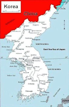
Map of Korea Before Koreran War
The Korean War (25 June 1950 - 27 July 1953) was a war between the
Republic of Korea (South Korea), supported by the United Nations, and the
Democratic People's Republic of Korea (North Korea), at one time supported by
China and the Soviet Union. The Korean Peninsula was ruled by
the Empire of Japan from 1910 until the end of World War II. Following the
surrender of the Empire of Japan in September 1945, American administrators
divided the peninsula along the 38th parallel, with U.S. military forces
occupying the southern half and Soviet military forces occupying the northern
half.
The failure to hold free elections throughout the Korean Peninsula in 1948
deepened the division between the two sides; the North established a communist
government, while the South established a right-wing government. The 38th
parallel increasingly became a political border between the two Korean states.
Cross-border skirmishes and raids at the 38th parallel
persisted. The situation escalated into open warfare when North Korean forces
invaded South Korea on 25 June 1950. In 1950, the Soviet Union boycotted the
United Nations Security Council. In the absence of a veto from the Soviet
Union, the United States and other countries passed a Security Council
resolution authorizing military intervention in Korea.
Before the invasion, Korea was
not included
in the strategic Asian Defense Perimeter outlined by
Secretary of State Acheson. Military strategists were more concerned with
the security of Europe against the Soviet Union than East Asia. This idiotcy
gave the North Korean carte blanche to invade as we didn't
care about Korea.
16 Maps to Show Monthly Time line of Opposing Forces in War
|