|
Bhutan
Background:
In 1865, Britain and Bhutan signed the Treaty of Sinchulu, under
which Bhutan would receive an annual subsidy in exchange for ceding some
borderland. Under British influence, a monarchy was set up in 1907; three years
later, a treaty was signed whereby the British agreed not to interfere in
Bhutanese internal affairs and Bhutan allowed Britain to direct its foreign
affairs. This role was assumed by independent India after 1947. Two years
later, a formal Indo-Bhutanese accord defined
India's responsibilities in defense and foreign relations.
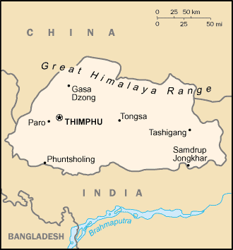
Location:
Southern Asia, between China and India.
Area: Total: 47,000 sq km.
Area - comparative: About half the size of Indiana.
Land boundaries: Total: 1,075 km, border countries: China 470 km, India 605
km.
Climate and Terrain:
Climate: Varies; tropical in southern plains; cool winters and hot summers in
central valleys; severe winters and cool summers in Himalayas.
Terrain: Mostly mountainous with some fertile valleys and savanna.
Elevation extremes: Lowest point: Drangme Chhu 97 m, highest point: Kula
Kangri 7,553 m.
Land use: Arable land: 2%, forests and woodland: 66%.
People:
Population: 2,049,412, note: other estimates range as low as 800,000.
Ethnic groups: Bhote 50%, ethnic Nepalese 35%, indigenous or migrant tribes
15%.
Religions: Lamaistic Buddhist 75%, Hinduism 25%.
Languages: Dzongkha (official), Bhotes speak various Tibetan dialects, Nepalese
speak various Nepalese dialects
Government:
Government type: Monarchy; special treaty relationship with India.
Capital: Thimphu.
Economy overview:
The economy, one of the world's smallest and least
developed, is based on agriculture and forestry, which provide the main
livelihood for more than 90% of the population. Agriculture consists largely of
subsistence farming and animal husbandry. Rugged mountains dominate the terrain
and make the building of roads and other infrastructure difficult and
expensive. Bhutan's hydropower potential
and its attraction for tourists are key resources. Detailed controls and
uncertain
policies in areas like industrial licensing, trade, labor, and finance continue
to hamper foreign investment.
Labor force - by occupation: Agriculture 93%, services 5%, industry and
commerce 2%.
Industries: Cement, wood products, processed fruits, alcoholic beverages,
calcium carbide.
Exports - commodities: Cardamom, gypsum, timber, handicrafts, cement, fruit,
electricity (to India), precious stones, spices.
Statistics:
Telephones - main lines in use: 6,000.
Radio broadcast stations: AM 0, FM 1, shortwave 1.
Radios: 37,000.
Television broadcast stations: 0.
Televisions: 11,000.
Internet users: 500.
Railways: 0 km.
Highways: Total: 3,285 km, paved: 1,994 km, unpaved: 1,291 km.
Airports - with paved runways: , with unpaved runways: 1.
Return to Visiting Locations
|