|
Navassa Island
Background:
Location:
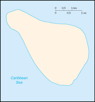
Location: Caribbean, island in the Caribbean Sea, about one-fourth of the way
from Haiti to Jamaica.
Area: Total: 5.2 sq km.
Area - comparative: About nine times the size of The Mall in Washington, DC.
Coastline: 8 km.
Maritime claims: Exclusive economic zone: 200 NM, territorial sea: 12 NM.
Climate and Terrain:
Climate: Marine, tropical.
Terrain: Raised coral and limestone plateau, flat to undulating; ringed by
vertical white cliffs (9 to 15 m high).
Elevation extremes: Lowest point: Caribbean Sea 0 m, highest point: unnamed
location on southwest side 77 m.
Natural resources: Guano.
Land use: Arable land: 0%.
Geography - note: Strategic location 160 km south of the US Naval Base at
Guantanamo Bay, Cuba; mostly exposed rock, but enough grassland to support goat
herds; dense stands of fig-like trees, scattered cactus.
|
|
People:
Population: Uninhabited. Note: transient Haitian fishermen and others camp on
the island.
Government:
Dependency status: Unincorporated territory of the US; administered from
Washington, DC, by the Fish and Wildlife Service, US Department of the
Interior; in September 1996, the Coast Guard ceased operations and maintenance
of Navassa Island Light, a 46-meter-tall lighthouse on the southern side of the
island; there has also been a private claim advanced against the island
Disputes - international: Claimed by Haiti.
Economy overview:
No economic activity.
Statistics:
Ports and harbors: None; offshore anchorage only.
Return to US Minor Outlying Islands
|