|
Northern Mariana Islands
Background:
Under US administration as part of the UN Trust Territory of the Pacific, the
people of the Northern Mariana Islands decided in the 1970s not to seek
independence but instead to forge closer links with the US. Negotiations for
territorial status began in 1972. A covenant to establish a commonwealth in
political union with the US was approved in 1975. A new government and
constitution went into effect in 1978.
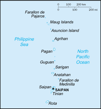
Location:
Location: Oceania, islands in the North Pacific Ocean, about three-quarters of
the way from Hawaii to the Philippines.
Area: Total: 477 sq km, note: includes 14 islands including Saipan, Rota, and
Tinian.
Area - comparative: 2.5 times the size of Washington, DC.
Coastline: 1,482 km.
Climate and Terrain:
Climate: Tropical marine; moderated by northeast trade winds, little seasonal
temperature variation; dry season December to June, rainy season July to
October.
Terrain: Southern islands are limestone with level terraces and fringing coral
reefs; northern islands are volcanic.
Natural resources: Arable land, fish.
People:
Population: 80,006.
Ethnic groups: Chamorro, Carolinians and other Micronesians, Caucasian,
Japanese, Chinese, Filipino, Korean.
Religions: Christian (Roman Catholic majority, although traditional beliefs and
taboos may still be found)
Languages: English, Chamorro, Carolinian, note: 86% of population speaks a
language other than English at home.
Government:
Dependency status: Commonwealth in political union with the US; federal funds
to the Commonwealth administered by the US Department of the Interior, Office
of Insular Affairs.
Government type: Commonwealth; self-governing with locally elected governor,
lieutenant governor, and legislature.
Capital: Saipan.
Economy overview:
The economy benefits substantially from financial assistance from the US. The
rate of funding has declined as locally generated government revenues have
grown. The key tourist industry employs about 50% of the work force and
accounts for roughly one-fourth of GDP. Japanese tourists predominate. Annual
tourist entries have exceeded one-half million in recent years, but financial
difficulties in Japan have caused a temporary slowdown. The agricultural sector
is made up of cattle ranches and small farms producing coconuts, breadfruit,
tomatoes, and melons. Garment production is by far the most important industry
with employment of 17,500 mostly Chinese workers and sizable shipments to the
US under duty and quota exemptions.
Statistics:
Telephones - main lines in use: 21,000.
Telephones - mobile cellular: 1,200.
Radio broadcast stations: AM 2, FM 3, shortwave 1.
Television broadcast stations: 1 (on Saipan and one station planned for Rota;
in addition, two cable services on Saipan provide varied programming from
satellite networks).
Railways: 0 km
Highways: Total: 362 km.
Airports - with paved runways: 3,
with unpaved runways: 3.
Heliports: 1.
Return to Visiting Locations
|