|
Palmyra Atoll
Background:
The Kingdom of Hawaii claimed the atoll in 1862, and the US included it among
the Hawaiian Islands when it annexed the archipelago in 1898. The Hawaii
Statehood Act of 1959 did not include Palmyra Atoll, which is now privately
owned by the Nature Conservancy. This organization is managing the atoll as a
nature preserve. The lagoons and surrounding waters within the 12 nautical mile
US territorial seas were transferred to the US Fish and Wildlife Service and
were designated a National Wildlife Refuge in January 2001.
Location:
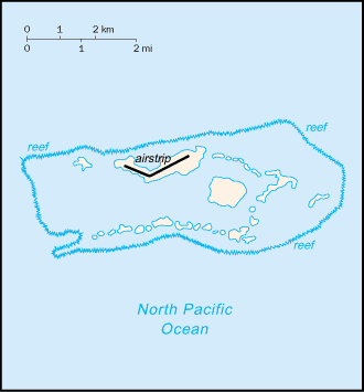
Location: Oceania, atoll in the North Pacific Ocean, about half way between
Hawaii and American Samoa.
Area: Total: 11.9 sq km.
Area - comparative: About 20 times the size of The Mall in Washington, DC.
Coastline: 14.5 km.
Maritime claims: Exclusive economic zone: 200 NM, territorial sea: 12 NM.
Climate and Terrain:
Climate: Equatorial, hot, and very rainy.
Terrain: Very low.
Elevation extremes: Lowest point: Pacific Ocean 0 m, highest point: unnamed
location 2 m .
Natural resources: Terrestrial and aquatic wildlife.
Land use: Arable land: 0%.
Geography - note: About 50 islets covered with dense vegetation, coconut trees,
and balsa-like trees up to 30 meters tall.
People:
Population: No indigenous inhabitants; 4 to 20 Nature Conservancy staff, US
Fish and Wildlife staff.
Government:
Dependency status: Incorporated territory of the US; privately owned, but
administered from Washington, DC, by the Fish and Wildlife Service of the US
Department of the Interior.
Economy overview:
No economic activity.
Statistics:
Highways: Most of the roads and many causeways built during World War II are
unserviceable and overgrown.
Ports and harbors: West Lagoon.
Airports: 1.
Return to US Minor Outlying Islands
|